![](/images/other/stat-length.png)
![Randonnée A pied Gemeinde Breitenstein - Payerbach - Sommerhöhe - Breitenstein - Photo](https://media.geolcdn.com/t/1900/400/8a6373ac-1ad9-4169-a7b0-aac7ea3d5304.jpeg&format=pjpeg&maxdim=2)
Payerbach - Sommerhöhe - Breitenstein
SityTrail - itinéraires balisés pédestres
Tous les sentiers balisés d’Europe GUIDE+
![Longueur](/images/other/stat-length.png)
![Altitude max](https://static1.geolcdn.com/siteimages/upload/files/1508320355ic_sort_altitude_max_24dp.png)
![Dénivelé positif](https://static1.geolcdn.com/siteimages/upload/files/1508320355ic_sort_den_pos_24dp.png)
![Km-Effort](/images/other/stat-length.png)
![Altitude min](https://static1.geolcdn.com/siteimages/upload/files/1508320355ic_sort_altitude_min_24dp.png)
![Dénivelé négatif](https://static1.geolcdn.com/siteimages/upload/files/1508320355ic_sort_den_neg_24dp.png)
![Boucle](https://static1.geolcdn.com/siteimages/upload/files/16400158638029165_repeat_loop_refresh_sync_direction_icon.png)
![A pied](https://static1.geolcdn.com/sitytour/trail-icons/100.png)
2h13
Difficulté : Facile
![Scannez ce code QR pour ouvrir la randonnée dans l'application SityTrail](https://capi.geolives.com/qq0zvz2zws4bq2lad0pu/sitytour/trails/3126583/qr.png?size=200)
Application GPS de randonnée GRATUITE
À propos
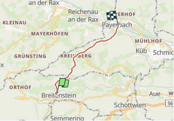
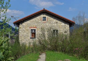
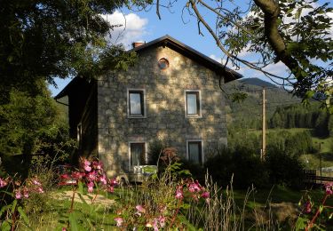
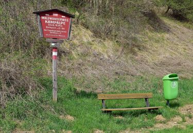
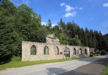
Randonnée A pied de 6,1 km à découvrir à Basse-Autriche, Bezirk Neunkirchen, Gemeinde Breitenstein. Cette randonnée est proposée par SityTrail - itinéraires balisés pédestres.
Description
Der ÖTK gilt als Pionier des Fremdenverkehrs. Heute ist der ÖTK mit über 360 Kursen und geführten Touren in 50 Freizeitsportarten der größte Anbieter im Outdoor-Segment in Österreich.
Site web: https://www.oetk.at
Localisation
Commentaires
Randonnées à proximité
![Randonnée A pied Gemeinde Payerbach - Payerbach - Steinhöfler - Photo](https://media.geolcdn.com/t/375/260/35bed2ee-e677-4a7b-b649-9bc6d92cee68.jpeg&format=jpg&maxdim=2)
![A pied A pied](https://static1.geolcdn.com/sitytour/trail-icons/100.png)
A pied
![](/images/other/stat-length.png)
![](https://static1.geolcdn.com/siteimages/upload/files/16400158638029165_repeat_loop_refresh_sync_direction_icon.png)
![Randonnée A pied Gemeinde Schottwien - Rundwanderweg - Photo](https://media.geolcdn.com/t/375/260/db4fa6e5-ce96-4cdc-8273-42b6f040655b.jpeg&format=jpg&maxdim=2)
![A pied A pied](https://static1.geolcdn.com/sitytour/trail-icons/100.png)
A pied
![](/images/other/stat-length.png)
![](https://static1.geolcdn.com/siteimages/upload/files/16400158638029165_repeat_loop_refresh_sync_direction_icon.png)
![Randonnée A pied Gemeinde Spital am Semmering - Steinhaus - Kampalpe - Photo](https://media.geolcdn.com/t/375/260/306613f3-0f53-42ad-b06a-514a9140896c.jpeg&format=jpg&maxdim=2)
![A pied A pied](https://static1.geolcdn.com/sitytour/trail-icons/100.png)
A pied
![](/images/other/stat-length.png)
![](https://static1.geolcdn.com/siteimages/upload/files/16400158638029165_repeat_loop_refresh_sync_direction_icon.png)
![Randonnée A pied Gemeinde Spital am Semmering - Bärenwand Rundwanderweg - Photo](https://media.geolcdn.com/t/375/260/2f007195-05e2-4cc4-990c-57c7abc8b2df.jpeg&format=jpg&maxdim=2)
![A pied A pied](https://static1.geolcdn.com/sitytour/trail-icons/100.png)
A pied
![](/images/other/stat-length.png)
![](https://static1.geolcdn.com/siteimages/upload/files/16400158638029165_repeat_loop_refresh_sync_direction_icon.png)
![Randonnée A pied Gemeinde Semmering - Semmering - Dürrgraben - Photo](https://media.geolcdn.com/t/375/260/494cca08-70d7-4e41-8dfc-895f4167fac4.jpeg&format=jpg&maxdim=2)
![A pied A pied](https://static1.geolcdn.com/sitytour/trail-icons/100.png)
A pied
![](/images/other/stat-length.png)
![](https://static1.geolcdn.com/siteimages/upload/files/16400158638029165_repeat_loop_refresh_sync_direction_icon.png)
![Randonnée A pied Gemeinde Spital am Semmering - Fröschnitz - Schwarzenberglift - Photo](https://media.geolcdn.com/t/375/260/b058c09d-6188-423f-94f4-564c1090344a.jpeg&format=jpg&maxdim=2)
![A pied A pied](https://static1.geolcdn.com/sitytour/trail-icons/100.png)
A pied
![](/images/other/stat-length.png)
![](https://static1.geolcdn.com/siteimages/upload/files/16400158638029165_repeat_loop_refresh_sync_direction_icon.png)
![Randonnée A pied Gemeinde Spital am Semmering - Steinhaus - Rettenberg Rundwanderweg - Photo](https://media.geolcdn.com/t/375/260/2a068d3f-0039-428b-ae0f-e6eb8d6719ae.jpeg&format=jpg&maxdim=2)
![A pied A pied](https://static1.geolcdn.com/sitytour/trail-icons/100.png)
A pied
![](/images/other/stat-length.png)
![](https://static1.geolcdn.com/siteimages/upload/files/16400158638029165_repeat_loop_refresh_sync_direction_icon.png)
![Randonnée A pied Gemeinde Breitenstein - Talhof - Semmering - Photo](https://media.geolcdn.com/t/375/260/1985eb2a-fc53-4d34-bbf9-d20f75c68b19.jpeg&format=jpg&maxdim=2)
![A pied A pied](https://static1.geolcdn.com/sitytour/trail-icons/100.png)
A pied
![](/images/other/stat-length.png)
![](https://static1.geolcdn.com/siteimages/upload/files/16400158638029165_repeat_loop_refresh_sync_direction_icon.png)
![Randonnée A pied Gemeinde Spital am Semmering - Wanderweg 4 - Photo](https://media.geolcdn.com/t/375/260/8cc7f79c-2af4-49e2-acdc-c5d5cbb0c9b3.jpeg&format=jpg&maxdim=2)
![A pied A pied](https://static1.geolcdn.com/sitytour/trail-icons/100.png)
A pied
![](/images/other/stat-length.png)
![](https://static1.geolcdn.com/siteimages/upload/files/16400158638029165_repeat_loop_refresh_sync_direction_icon.png)